Cycling by Numbers - Finding Your Way!
How does it work?
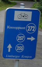
It’s really easy. The Belgians have a brilliant system for navigating the cycling path network! Main intersections in the bike track network have been assigned a number. You’ll find them on the map we provide you wit
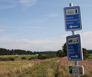
These are examples of the kind of signs you will see on your tour:


At every numbered intersection there’s a big sign with a map of the surroundings where you can see where you are and what options you have, just like on the map that we provide you with.
In Wallonia, there's a RAVeL network, more than 1300km of trails for non-motorized traffic. On the RAVeL signs you always see the nearest cities and the nr. or name of the RAVeL.


For our tours, we sometimes use a combination of cycling-by-numbers and fixed routes, sending you along short stretches of long-distance routes, for example. This works just fine because the two systems tie in nicely. You’ll also find route directions in your travel documents.
Please watch the video below for an explanation about the cycling-by-numbers system.


